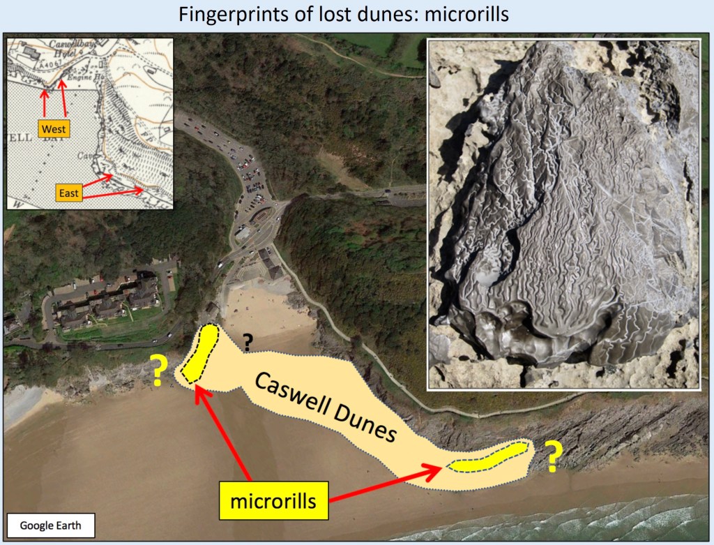
Originally this page had just a few interesting physical features as pictures and a video. Now, since January 2022, I have become increasingly interested in the evidences that huge amounts of sand are being permanently lost from south Gower beaches. In the book, and in another section here, on Helwick sand bank, I explain that this has nothing to do with dredging activities and I interpret microrills as evidence of sand dunes that have been lost. I tentatively suggested that the sand loss is a natural recovery from the besanding that occurred during the Little Ice Age – an equilibrium being restored, or at least change back following those grim centuries of sand being driven up onto the coast, a phenomenon now thankfully much reduced.
I have recently been impressed by the increasing extent of exposure of features where once, in my youth, there was mainly continuous sand. Several other people have made similar observations. Below are a couple of recent pictures from Oxwich. (See also photographs of wreck piles of quarried limestone at Caswell in the excellent History of Mumbles: Limestone Quarrying in Oystermouth Parish by Carol Powell). I would greatly appreciate hearing from people who have old pictures that demonstrate the sand loss. I recently found additional microrills high on the isolated pinnacle in Rotherslade, indicating that dunes once existed there, rather as in Caswell (my book Section 6.4, Fig. 144). See the final image below concerning the original occurrence of dunes at Caswell. All of this needs further gathering of information. It is quite important for Gower.
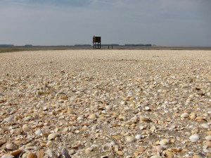
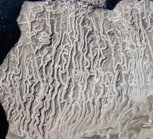
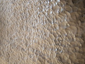
Uncommon trails (about 1 cm wide), formed by wind-blown foam bubblesCockle-shell-rich mound about 1 metre high concentrated by estuary currents near the war-time observation post 2 km north of Weobley Castle; it moves in time…Sun halo caused by ice crystalsMillimetre-scale microrills on limestone involve capillary forces acting against gravityScalloping on a limestone sea-cave wall, due to fluid-dynamic instabilities and associated dissolution
Roll waves between Broughton and Blue Pool cornerTwo giant timbers of the so-called ‘fossil forest’ have long been exposed and were known to fishermen using nets more than 60 years ago, while nearby (foreground) the reworked glacial till substrate to the trees is increasingly exposed, suggesting a little sand loss here (Oxwich Beach SS52252 87526).Mid-beach farther west lies an elongate, double-pointed pile of mainly angular limestone blocks that must have been a quarried boat-load bound for the other side of the Bristol Channel. Wooden hulled sailing boats, known as “muffies”, were designed for the limestone and coal trade with Devon. Presumably the loaded boat foundered here, where the load collapsed and spread to its present shape of 29 m x 14 m. The beach now is much more stony than it was when we were kids, and at least some of us old timers have no recollection of this boat-shaped pile of limestone blocks being exposed then. West of the rock pile further metal wreckage now protrudes in several places. Far more sand, probably more than 1 m thickness, appears to have been lost, in contrast to farther east. Does anyone have more information? (Oxwich Beach SS50624 86776).